3D MODELING AND ANALYSIS
When Accuracy, Safety, and Reliability Matter Most
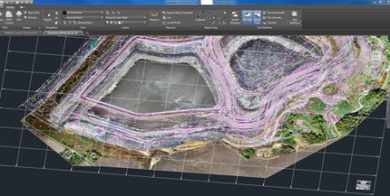
UAVs can be deployed rapidly to obtain high resolution imagery and ground elevation data. Using this information we can create detailed contour maps and orthophotos, and provide accurate material measurements without compromising safety. Using Ground Control Points along with the low elevation, high resolution elevation data results in highly accurate maps and data. The results include highly accurate georeferenced orthophotos , 3d point cloud models, and volumetric calculations. The final formats can be provided in AutoCAD or GIS, or a variety of other platforms.
Volumetric Applications:
Volumetric Services (stockpile, over-burden, yardage placement, etc.)
Monthly Cost Analysis
Valuation Services
Active and As Mined Maps
Profile and Cross Sections
Construction Planning
Monthly, Quarterly, Annual or Emergency Stockpile Volumes


